

Shimoga Circle has a geographical area of 9491 square miles. It is the home of forests and wildlife, full of potential for forest based industries and further development. The vastness and density of forest wealth and the tempo of works has necessitated formation of seven Forest Divisions – three in Shimoga District, three at Chikmagalur District and one at Hassan each under a Deputy Conservator of Forests. The Western Region of the Circle is generally hilly sometimes precipitous, easing out into the plains on the Eastern side.
It is bestowed with wholesome water resources, with Eastern flowing rivers like Bhadra, Tunga, Kumudhwati, Hemavathi, Cauvery, Varahi and only the Sharavathi flowing Westwards. The land is full of historical relics and legends. The rainfall varies from 10†on the Eastern side around Kadur to over 350†at Agumbe.
A variety of soils are met with. The climate is generally solubrious except for the months of December and January which are cold and foggy and summer months are generally hot. There is no frost. With the prevailing factors of locality the vegetation varies in its density and composition.
The tropical scrub forests and the dry deciduous forests with a preponderance of Sandal and stunted pole forests of Teak and Dindiga, the moist deciduous forests – the richest timber forsts abounding in species like rosewood, honne, nandi, teak and bamboos. The semievergreen forests with species like nandi, halasu, dhupa and other softwoods and the veritable tropical moist and wet evergreen forests rich in Balagi, Dhuma and other softwoods characteristic of the tropical rain forest are all met with in the circle. Thus, the most valuable belt is the dry deciduous and the moist deciduous forests, yielding Sandal and the best hardwood timbers to the Government Depots to meet public demands of timber and special supplies.
This decidious zone is also the home of the two species of bamboo, Dendrocalamus strictus and Bambusa arundinacea, the mainstay of the paper industry. The semievergreen and evergreen forests supply the bulk of softwoods for the match and plywood industries, balagi sleepers to Railways and balagi electric transmission poles and telephone and telegraphic poles. Besides the total area of 2157.48 square miles of forests which includes 1631.49 square miles of State forests and 526 sq. miles of minor forests, forest plantations, village forests and reserve lands under the control of the Forest Department, 4,86,285 acres of land, till recently under the control of the Revenue Department, have now been ordered to be transferred to the control of the Forest Department for protection and improved management.
These are mostly in Chikmagalur and Shimoga Districts under different nomenclatures like Gomals, assessed waste, kharab kans or District Forest. Sometimes they contain very valuable and richly wooded areas in the central and Western region and scrub areas with Sandal on the Eastern side. The kans are the sources of streams and rivulets.
The forests in the Circle form 22% of the land area as against 18.1% for the State, and 21.4% for India as a whole. There is an urgent need for bringing more land under forests specially in Hassan District where forests are only 7% of the land area and if balanced and proper land use is aimed at. Besides the area now proposed to be handed over to the Forest Department, there are still vast stretches of land with good rainfall not suited to agriculture but retained for ‘gomal’ under the Revenue Department which could be conveniently handed over to the Forest Department.
Extensive stretches of grass lands on the hills of the Western Ghats pose a challenge to the forester in afforestation.(Source: This is an abstract taken from the 'My forest' Journal; March - June 2017. The author is Santosh Y. M.
L. Sharma, MSc., A.I.F.C. You can read the entire article at aranya.gov.in)
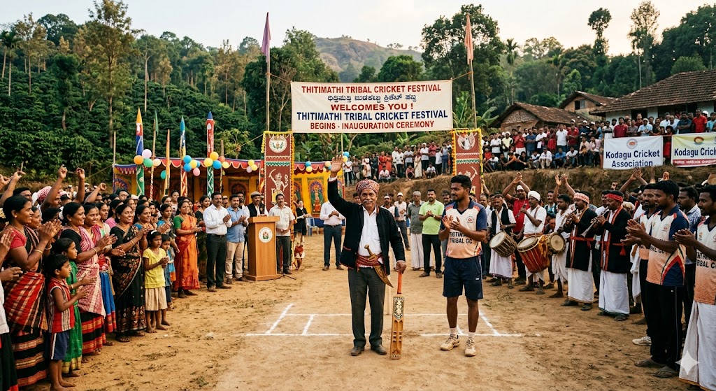
Tribal cricket festival begins in Thitimathi...
Read More

Chennaiyinkote Premier League Team Smash Champions...
Read More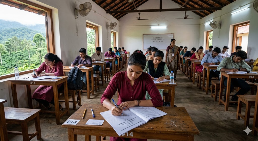
First place in the state after writing the re-examination...
Read More