

This is how misinformation gets accepted as fact.
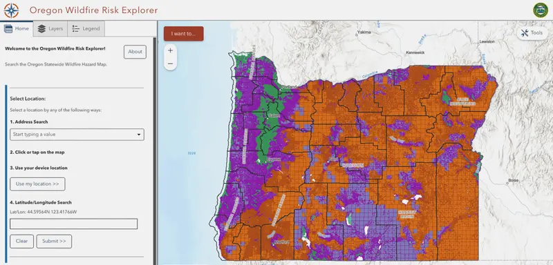
A year after Oregon endures its most destructive fire season on record in 2020, state lawmakers order a map estimating the wildfire risk for every property in the state. It’s the kind of rating now available on real estate sites like Zillow. The state wants to use the results to decide where it will apply forthcoming codes for fire-resistant construction and protections around homes.
Around the same time, insurance companies start dropping Oregon homeowners’ policies and raising premiums to limit future losses, much as they have done in other disaster-prone states. Insurers have their own sophisticated risk maps to guide them, but some brokers instead tell homeowners the blame lies with the map the state produced. The belief gets treated as fact both on social media and in mainstream news — even though insurers and regulators say it’s not true.
The anger quickly spreads. Not only is Oregon’s map seen as at fault for higher insurance premiums, one conservative talk radio host calls it an attempt to “depopulate rural areas.” People in an anti-map Facebook group start musing about “Agenda 21,” a conspiracy theory implicating the United Nations in an effort to force people into cities so they can be more easily controlled.
By the time the state pulls back the map and starts over, the myths about it have gained so much momentum there’s no stopping them. Oregon’s hotter, drier climate isn’t the problem; the map is.
Christine Drazan, the Oregon House Republican leader, joins more than a dozen other Republicans in February 2025 behind a sign that says “REPEAL THE WILDFIRE HAZARD MAP.” She calls the state’s map “faulty, defective, harmful” and says it, along with related fire-safe building and landscaping rules that are in the works, is “a heavy-handed bureaucratic takeover” that’s kept rural residents from insuring or selling homes.
“This map is destroying their property values,” she says.
In the end, what’s most remarkable about the campaign against Oregon’s wildfire map isn’t that misinformation found an audience.
It’s that it worked.

Chris Dunn, a wildfire risk scientist at Oregon State University and a former wildland firefighter, thought Oregon had a chance to be a national model for adapting to wildfire risks when he was asked to make the statewide map in 2021.
Oregon adopted a unique set of land use laws in the late 1960s and 1970s that helped curb urban sprawl. A coalition of farmers and conservationists formulated the legislation to preserve farmland and keep cities compact. To Dunn, protecting homes seemed within reach because the state had maintained agricultural buffers around cities, helping to serve as firebreaks.
At the time, Zillow hadn’t yet come out with risk ratings. By building its own map, Oregon could use local input and make adjustments as it went along.
The map results would help Oregon decide where to require a tool proven to save homes from wind-driven wildfires: “defensible space.” Owners would have to prune trees up and away from their houses; they would need to keep their roofs clear of leaves, needles and other dead vegetation. The idea was to deny wind-borne embers fuel that can burn down dwellings — a problem fresh on lawmakers’ minds after Oregon’s devastating 2020 fire season destroyed more than 2,000 homes.
Dunn knew public communication would be important. Before the map was released, a private property rights group had warned its members in a letter that the map and its rules were worrisome. Gov. Kate Brown’s wildfire council, advising state leaders about the map’s rollout, knew about the letter and the potential for pushback, according to emails Dunn provided to ProPublica.
Dunn said he was clear with Brown’s wildfire director, Doug Grafe, and others on the council that the map needed a significant, coordinated and effective communications campaign starting months before its release. Dunn said all the state developed was a one-page document on the roles of each government agency.
(Brown and Grafe did not respond to ProPublica’s questions. Grafe told Oregon Public Broadcasting in 2022 that “we are committed to ensuring people understand what they can do to increase the likelihood their homes and properties will survive wildfires.”)
Without state outreach, many homeowners learned their homes were in “extreme risk” zones from a July 2022 letter in the mail. It gave them 60 days to appeal the designation or face complying with new building and defensible-space codes the state was developing.
Dunn could see that an uproar was building around his work. One community meeting where he was scheduled to present was canceled after state officials received threats of violence.
On Facebook, more than 6,000 people joined a private group, ODF Wildfire Risk Map Support, a base of opposition. ODF stands for the Oregon Department of Forestry, the state agency overseeing the map’s creation.
One member warned that state officials would snoop around their rural properties to tell owners what to do.
“Guys this is a agenda 21,” said the member, referencing the conspiracy theory promoted in part by former Fox News talk show host Glenn Beck.
Along with 31 thumbs-ups, eight angry faces and several other emojis, the post got 24 comments.

More articles for you
Helmet Safety Awareness Campaign
July 20, 2026
Helmet Safety Awareness Campaign...
Read MorePro-Hindu Groups Protest Alleged Mass Conversion Prayer Event
July 20, 2026
Pro-Hindu Groups Protest Alleged Mass Conversion Prayer Event...
Read MoreA Heartfelt Tribute to Gaana Kogile S. Janaki
July 20, 2026
A Heartfelt Tribute to Gaana Kogile S. Janaki...
Read MoreRoad Closure Alert Issued in Bhagamandala
July 18, 2026
Road Closure Alert Issued in Bhagamandala ...
Read More