

Karnataka has a rich history of laying permanent plots and studying the changes over long period of time. After the 3rd Silvicultural Conference held at Dehradun in the year 1929 Linear Tree Increment (LTI) Plots were laid in the Western Ghats area. There are 23 LTI Plots.
Once in 5 years the growth data is recorded although there are lot of gaps in the information. Once such plot at Agumbe has been revived in 2017, as no data was available after 1955. The plot was measured once again, the trees labeled and growth recorded.
During last few decades the forest ecosystem are getting affected not only from human activity but also the changes that are the happening because of climate change. The effect on forest species composition, regeneration is bound to happen and it is high time the Forest Department monitors such changes. Eco-systems, world over are undergoing changes and it is very important to document these changes starting with a base line data. The effect of anthropogenic activities and Climate Change on forest dynamics has to be recorded and monitored.
This long term study can help us plan management interventions for best results in terms of forest protection and conservation. Plots have been located in deep forest with least human influence. Relatively small changes in the structure and/or function of these forests could have global and regional consequences for biodiversity, carbon cycle and rate of climate change.
The present work is being undertaken in Western Ghats, a hotspot of diversity in the world to understand forest dynamics in the light of climate change and such non-anthropogenic factors. The Research Wing has laid four such long term Ecological Monitoring Plots of one hectare each in the western ghat area at (1) Agumbe (2) Seethanadi (3) Talakaveri and (4) Chakra. The plots are away from human influence and are basically to monitor the effect of climate change. A MoU has been signed with a local institution at Sringeri, Sri Jagadguru Chandrashekhara Bharathi Memorial (JCBM) College, with an aim to have continuity of observation. Broad ObjectivesThe objective of laying these long term Ecological Plots are as follows:1.
Quantify long term changes in forest biomass.2. Relate current forest structure, ecophysiology, biomass and dynamics to local climate and soil properties.3. Understand the relationships between productivity, mortality and biomass.4.
Use relationships to understand how changes in climate may affect the biomass and productivity of the forest as a whole, and form basin-scale model of carbon dynamics.Present goal;1. To document all plant species in 400 quadrants of the plot2. To analyze the diversity of documented herbs, shrubs, climbers & lianas and trees statistically3.
To know about regeneration status of the tree species4. To measure x & y axis of each individuals in each quadrant for long term monitoringStudy area;We are presenting the information for Agumbe and Seethanadi plots.1. AgumbeThe study area is situated in Mavina Beelu village of Agumbe State Forest, Survey No.
16, Thirthahalli taluk, Someshwara Wildlife Sanctuary lies between 13° 32.154 N to 13° 32.245 N latitude and 75° 04.523 E to 75° 04.589 E latitude. According to the Champion and Seth classification, Agumbe is an area of Southern tropical wet evergreen forests.2. Seethanadi The study area is situated in Someshwara south Reserve Forest (Someshwara Sanctuary) of Someshwara Wildlife Range, Kudremukh Wildlife Division, Survey No 126/1 of Nadpal Village, Karkala Taluk, Udupi District (GPS reading N 13.46080° E 75.02333°).
The forest is Moist deciduous-Semi evergreen forest with dense population of Hopea parvifl ora and Vateria indica.Methodology: One-hectare square (100m x 100m) plot is established. This main plot is divided into four subplots of size 50m x 50m and named A, B, C & D. Each subplot is divided into 100 quadrants of size 5m x 5m (Total 400 quadrants) (Fig.
1) by installing large laterite bricks at four corners of the each quadrant, driven well into the ground, with approximately 10 cm showing above the ground. The seedling and sapling of all tree species were tagged. In each plot some 14000 to 17000 tags have been used.Herbs and Shrubs: The herbs and shrubs in each quadrant are recorded and identify by using available manuals and flora.Climbers and Lianas: The presence of climbers and lianas, plant species infested with lianas, GBH (Girth at Breast Height) of both liana and infested tree were measured.
The bark texture of trees and climbing pattern of the liana was also noted down. In this work, the term liana is applied to all woody climbers with the GBH 3cm (Muthuram Kumar and Parthasarathy, 2001) and indeed twiners, scramblers, root climbers, hook climbers, tendril climbers all of which start their life on the forest floor.Trees: In each quadrant, the tree species ≥ 10 cm GBH are considered as trees and are documented and identifi ed by using available manuals and fl ora (Gamble 1998; Bhat, 2014; Saldanha and Nicolson, 1976; Gurudeva, 2001; Ramaswamy et al., 2001; Yoganarasimhan et al., 1981; Talbolt, 1909; Balakrishna Gowda 2004; Sachin A. Punekar and Lakshminarasimhan, 2011; Bhagat et al., 2008).(Source: This is an abstract taken from the My forest Journal; March - June 2017.
The authors are Dr. Kumaraswamy Udupa E.S. and Mr.
Sanjai Mohan, IFS. You can read the entire article at aranya.gov.in)
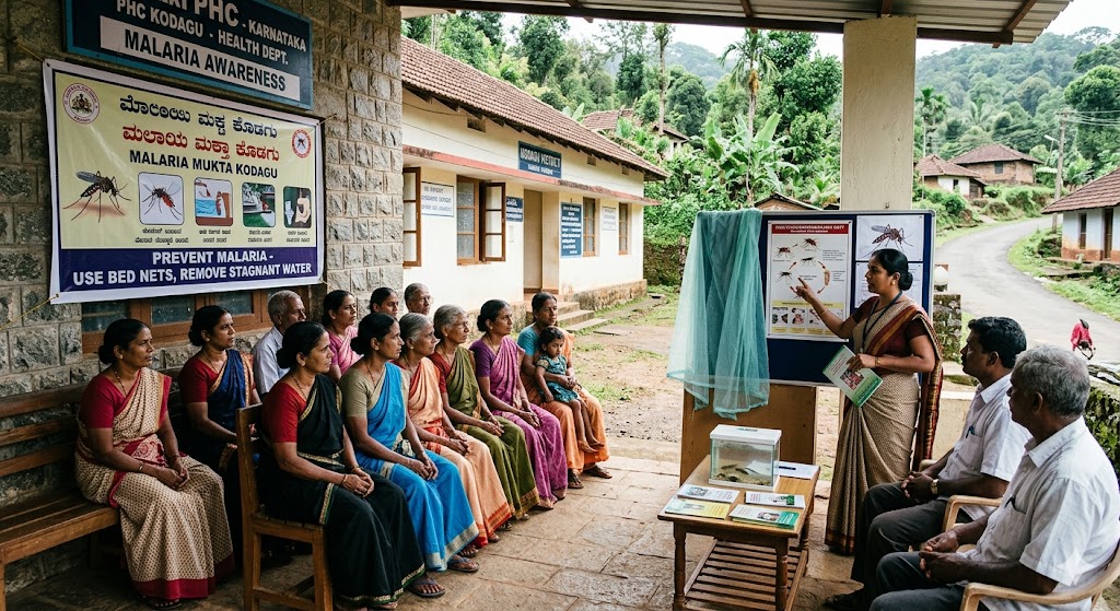
Awareness about malaria at the health center...
Read More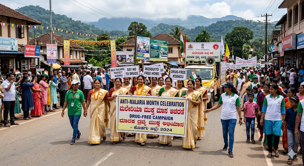
Anti-Malaria Month Observance and Drug-Free Awareness Campaign...
Read More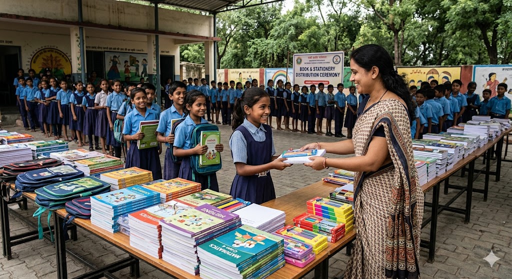
Books and stationery distributed to students...
Read More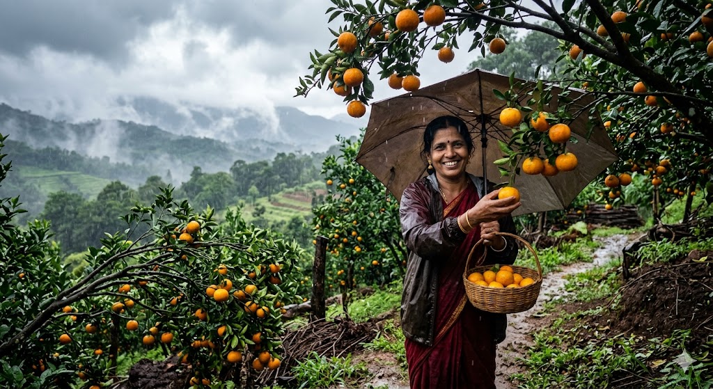
Summer oranges herald the arrival of the monsoon season....
Read More