

As the summer holidays come to an end, it seems like we're going out with a bang - but not in the way we'd hoped. Despite donning rain ponchos, many of us will still end up getting soaked today as forecasters from the Met Office have issued a thunderstorm warning for a large portion of England and eastern Wales. This includes major cities like London, Newcastle-upon-Tyne, and even the Isle of Wight.
The warning, which is in effect from 4am to 9pm on Sunday, is a result of a large thunderstorm system moving through the area. However, not all hope is lost as some areas in the far northwest of England can expect drier and brighter conditions, while those in the southeast may experience warm and humid weather with temperatures reaching up to 30C. But as deputy chief meteorologist Dan Harris warns, this is all dependent on the clouds breaking and the warmer weather will only be a brief respite.
Unfortunately, it doesn't look like the rain will be letting up anytime soon. Thundery downpours are expected to hit southern England, the Midlands, the north of England, and eastern parts of Wales on Sunday. The Met Office spokesperson explains that while a few showers and isolated thunderstorms may develop on Saturday night, Sunday morning will bring heavier and more organized showers.
These storms will then move northwards throughout the day and into the early evening. But the extent of the thunderstorms is uncertain and not all areas will be affected. However, in places where the storms do occur, there is a risk of 30 to 40 mm of rain falling in less than an hour, with some areas possibly experiencing over 75 mm.
This could lead to flooding and disruption, and the Met Office has issued a yellow warning for thunderstorms in these areas. The meteorologists also warn of a small chance of flooding and disruption from heavy showers and thunderstorms on Sunday, which could result in power cuts, damage to buildings, and difficult driving conditions. They advise caution and to be prepared for road closures and disruptions to train and bus services.
Frequent lightning strikes and hail are also expected, especially in southern and central England. This summer has been cooler than usual in the UK, with slightly below average sun according to the Met Office's latest statistics. While rainfall has been average, there was a heatwave in September last year with temperatures reaching over 30C for seven consecutive days.
As we bid farewell to the summer, it seems like Mother Nature has one last show in store for us - and it's not exactly the grand finale we were hoping for.

Odisha govt issues SOP for apartment registration to increase transparency and efficiency, addressin...
Read More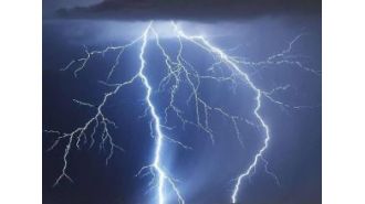
Eight people, including two women and a two-year-old boy, died from lightning strikes in various dis...
Read More
Nicky Campbell described the night as lengthy and full of intense feelings....
Read More
Urban Garden Brewing's unique menu features botanical, herb, and flower-inspired dishes....
Read More