October 6th 2024.
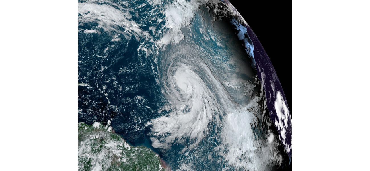
A powerful storm is currently making its way towards the UK, causing concerns for potential disruption and damage. Hurricane Kirk, which originated in the Atlantic Ocean, has weakened but is still capable of wreaking havoc as it approaches our shores. This comes on the heels of previous storms and flooding, adding to the unsettled atmosphere in the country.
The Met Office, responsible for monitoring weather conditions, has issued a warning for the upcoming week. They predict that we will experience strong winds and heavy rain as the remnants of Hurricane Kirk move across the Atlantic towards us. While initial forecasts showed the storm heading directly towards the UK, recent updates suggest that it may instead hit northern France. However, as with any weather system, there is always a level of unpredictability involved.
Forecasters shared a video last night showing the possible paths that Hurricane Kirk may take as it transforms into an ex-hurricane and moves towards northwest Europe. The lines on the map indicate different potential tracks, all of which show the storm heading towards France. But as we know, the weather can be fickle and these predictions are not set in stone.
Despite the uncertainty, there is still a threat that the UK will be affected by the storm. The Met Office advises that the southern parts of England are most at risk, while Scotland and Northern Ireland may experience colder temperatures and showers. Towards the end of the week, these colder conditions may spread further south. However, it is difficult to predict the exact details at this stage.
Hurricane Kirk has already caused chaos in the tropics, with winds reaching up to 145mph. Thankfully, there are currently no weather warnings in place for the UK. Chris Bulmer, the Met Office's deputy chief meteorologist, explains that there is still a lot of information to gather in order to determine the exact track and timing of the storm. However, it is likely that England and Wales will bear the brunt of the heavy rain and strong winds.
As we head into the rest of October, the Met Office predicts that we will continue to experience low pressure systems coming in from the Atlantic. This means that we can expect wet and windy weather, especially in England and Wales. However, there is a chance that Scotland and Northern Ireland may see some breaks in the weather and drier spells. Only time will tell, and we must remain vigilant and prepared for any potential storms that may come our way.
[This article has been trending online recently and has been generated with AI. Your feed is customized.]
[Generative AI is experimental.]