
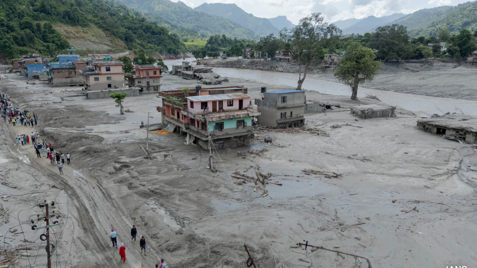

Thousands of people died in the floods that occurred in Nepal on August 26, and thousands more are still missing. Scientists and meteorologists are busy searching for the exact cause of the floods, and in the meantime, some media outlets and social media outlets are creating speculations without scientific evidence and portraying this as the cause of the floods. Some media outlets are also promoting the idea that China caused the floods by dumping water.
Meanwhile, the U.S. Geological Survey has provided a credible explanation for the possibility of floods based on reports that have been studied in this area for decades, including satellite images and seismological equipment.
The details are as follows:
The U.S. Geological Survey says that the cause of the floods is glacial collapse. More than 3,000 large glaciers in Nepal are at risk of melting due to increasing global temperatures. The current location of the glacier collapse is identified as the Yala Glacier. The Yala Glacier has melted 66 percent since 1970 due to global warming. This melting has accelerated in the last decade, and in May 2025, the glacier was officially declared ‘extinct’.
The glacier that collapsed on August 26 was still high above the Yala region, clinging to the mountain. The collapsed glacier was one and a half km wide. The area is 16,700 feet above sea level. The glacier collapsed at 10:52 am on the 26th. Nepal is currently experiencing its highest temperature on record this summer. The current collapsed glacier had snowed in January. No matter how much direct sunlight falls on the snow on the glacier, the white snow reflects it back to the sky (white is highly reflective), which is why the glacier under the thick snow was safe from melting. But this summer's high temperatures have melted the thick snow on the glacier. The glacier, which has a hard layer of rock and is slightly gray, is therefore directly exposed to sunlight. Since the gray color does not reflect the rays like white, it absorbs more rays and the heated glacier melts and collapses. (If you look at the satellite images taken in the winter of January, the snow on the glacier seems to have dispersed. There are several reasons for this, and the possibility of a small earthquake cannot be ruled out, this earthquake could have been in January and not in August).
The one and a half km wide glacier that collapsed has fallen from a height of 16,700 feet into the area of the Yala Glacier that was previously below it. This one and a half km wide glacier has scattered all the silt and soil that was left in the area due to the melting of the Yala Glacier. Then, the glacier, which slid down a valley between the mountains about 5.4 km away, has fallen from its original height of 16,700 feet to a height of about 9,000 feet, that is, 7 thousand feet. As a result, the glacier has almost melted and joined the river of water 5.4 km away.
The flash flood was caused by the water of the one and a half km wide glacier joining the river that normally flows smoothly on the slopes of the huge mountains in the Himalayan valley. The river water in the valley between the mountains has risen 300 feet above its normal level..!
A 300-foot-high water, more powerful than a tsunami, reached the China-Nepal checkpoint on the river bank, 21 km from the crash site, within minutes. The checkpoint was 6,000 feet above sea level. To reach it, the glacier water had dropped from its original height of 16,700 feet to 6,000 feet—more than 10,000 feet.
In just 21 km, the water (melted glacier) had dropped 10,000 feet (a steep drop). This happened in 7 minutes, and the water was flowing at a speed of 168 km per hour, destroying the entire area of the checkpoint. (For comparison: The Cauvery has to flow 800 km from a height of only 4,000 feet above sea level to reach the Bay of Bengal, which means the slope is very low.)
The water that destroyed this checkpoint and moved downstream has destroyed the riverbank areas and bridges even after moving 72 km due to the glacier collapse. Global warming is causing the glaciers in the North and South Poles of the Earth to melt, causing sea levels to rise. If a glacier melts in a high-altitude area like the Himalayas, a significant amount of water enters the river and creates floods.
In the Nepal disaster, out of the tens of thousands of glaciers in a sensitive area like the Himalayas, only one glacier melted..! More than 3,000 glaciers in the country of Nepal alone are facing the threat of melting..!
Disclaimer: This article has been translated by xklsv.com using advanced AI-based translation tools. Please note that the use of AI for translation is still experimental and may not be 100% accurate. The original content is sourced from shakthidaily.info, and Shakthi Daily is not responsible or liable for any errors, omissions, or inaccuracies that may appear in the translated version, including spelling, grammar, or contextual misunderstandings.
If you come across any mistakes or inconsistencies in this translation, we kindly request you to report them by sending an email to [email protected]
Your feedback will help us improve the quality.
The image in this article has been generated using artificial intelligence and is intended for illustrative purposes only. It may not reflect real-world accuracy.
New KSRTC Bus Service Introduced on the Madikeri–Bhagamandala–Talakaveri Route...
Read More
Gonikoppal Celebrates Mahila Dasara (Women's Dasara)...
Read More
Poetry Comes Alive Amid the Grandeur of Madikeri Dasara...
Read More
12 Kodagu Players Selected for Karnataka Hockey Team...
Read More